


HIGHER PARTS OF FLOYD COUNTY, MARTIN COUNTY, AND PIKE COUNTY, COULD SEE ABOVE EIGHT INCHES OF SNOW; ANOTHER SNOW SYSTEM FORECAST TO COME THROUGH THURSDAY EVENING INTO FRIDAY, NEAR ZERO DEGREES ON SATURDAY NIGHT
JANUARY 14, 2024 – written by WADE QUEEN
After Louisa and the rest of Lawrence County getting a surprise snow dusting of about half an inch on Sunday morning, January 14; it is going to be a rough week for the next seven days in Eastern Kentucky, as significant winter weather woes will be affecting our local area and the surrounding region.
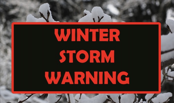
The National Weather Service in Charleston, West Virginia issued on Sunday afternoon a Winter Storm Warning for our region.
- Lawrence County, KY., *Boone County, WV, *Kanawha WV *Lincoln, WV, *Logan, WV, *Mingo, WV, *Putnam, WV, *Wayne, WV.
...WINTER STORM WARNING IN EFFECT FROM 1 AM MONDAY TO 7 AM EST
TUESDAY...

* WHAT...Heavy snow is expected. Total snow accumulations of 3 to 6
inches.

* WHERE...Portions of northeast Kentucky and southeast, southern
and western West Virginia.

* WHEN...From 1 AM Monday to 7 AM EST Tuesday.

* IMPACTS...Travel could be very difficult. The hazardous
conditions could impact the morning or evening commute.

* ADDITIONAL DETAILS...A lull in snowfall is expected late Monday
morning before heavier snowfall resumes Monday afternoon.

PRECAUTIONARY/PREPAREDNESS ACTIONS...

If you must travel, keep an extra flashlight, food, and water in
your vehicle in case of an emergency.

Additional information can be found at
https://www.weather.gov/rlx as well as on our Facebook and
Twitter pages.
The Winter Storm Warning for *Johnson County, KY., reads as the following:
* WHAT…Heavy snow expected. Storm total snow accumulations of 2 to 6 inches with the higher accumulations in the southeastern portions of each county. * WHERE…Portions of northeast, south central and southeast Kentucky. * WHEN…From 9 PM this evening to noon EST Tuesday. * IMPACTS…Travel could be difficult. The hazardous conditions could impact the morning or evening commute. * ADDITIONAL DETAILS…Two rounds of snow are expected. The first round will move in late this evening, before tapering off early Monday morning, with generally 1 to 3 inches of snowfall expected. The second round of snow arrives Monday afternoon and will continue through early Tuesday morning, producing another 1 to 3 inches of snowfall.
The Winter Storm Warning for *Floyd County KY., *Martin County, KY., *Pike County, KY., reads as the following:
* WHAT…Heavy snow expected. Total snow accumulations of 3 to 8 inches. Locally higher amounts in excess of 8 inches are possible, particularly at elevations above 1,500 feet. * WHERE…Portions of northeast, south central and southeast Kentucky. * WHEN…From 9 PM this evening to noon EST Tuesday. * IMPACTS…Travel could be very difficult to impossible. The hazardous conditions could impact the morning or evening commute.
Meanwhile these surrounding counties have been issued a *WINTER WEATHER ADVISORY, that reads as the following:
- Boyd County, KY.
- Cabell County, WV.
- Carter County, KY.
- Gallia County, OH.
- Greenup County, KY.
- Jackson County, WV.
- Lawrence County, OH.
- Mason County, WV.
* WHAT…Snow expected. Total snow accumulations of 1 to 3 inches. * WHERE…Portions of northeast Kentucky, southeast Ohio and central and western West Virginia. * WHEN…From 1 AM Monday to 1 PM EST Tuesday. * IMPACTS…Plan on slippery road conditions. The hazardous conditions could impact the morning or evening commute. * ADDITIONAL DETAILS…A lull in snow is expected late Monday morning.
- Elliott County, KY.
* WHAT…Snow expected. Total snow accumulations of 1 to 5 inches with the higher amounts generally toward the southeastern portions of each county. * WHERE…Portions of east central and southeast Kentucky. * WHEN…From 9 PM this evening to noon EST Tuesday. * IMPACTS…Travel could be very difficult. The hazardous conditions could impact the morning or evening commute. * ADDITIONAL DETAILS…Two rounds of snow are expected. The first round will move in late this evening, before tapering off early Monday morning, with generally up to 3 inches of snowfall expected. The second round of snow arrives Monday afternoon and will continue through early Tuesday morning, producing another up to 2 inches of snowfall.
- Braxton County, WV
- Calhoun County, WV
- Clay County, WV
- Roane County, WV
* WHAT…Snow expected. Total snow accumulations of 2 to 5 inches. * WHERE…Portions of central and northern West Virginia. * WHEN…From 1 AM Monday to 1 PM EST Tuesday. * IMPACTS…Travel could be very difficult. The hazardous conditions could impact the morning or evening commute. * ADDITIONAL DETAILS…A lull in snowfall is expected late Monday morning with heavier snowfall resuming late Monday afternoon.
- Nicholas County, WV.
* WHAT…Snow expected. Total snow accumulations of 3 to 5 inches. * WHERE…Portions of northeast and southeast West Virginia. * WHEN…From 1 AM Monday to 1 PM EST Tuesday. * IMPACTS…Travel could be very difficult. The hazardous conditions could impact the morning or evening commute. * ADDITIONAL DETAILS…A lull in snowfall is expected late Monday morning with heavier snowfall resuming late Monday afternoon.
After a very cold next three days, brief ‘warm-up’ with normal temperatures on Thursday, but a new winter comes in, starting as rain before turning over to accumulating snow Thursday night into Friday, with likely a lot of freezed up black road ice, bottoming out on Saturday night to near zero degree temperatures.
Luckily, the long term forecast is showing a warm-up on Monday, January 22, with temperatures in their 40s, and rising into the low to mid 50s on Tuesday, January 23.
Here is the preliminary weather forecasts for from Sunday night January 18; to Monday, January 29:

Variably cloudy with snow showers. Low 19F. Winds light and variable. Chance of snow 50%.
Cloudy. Snow showers developing in the afternoon. High 26F. Winds light and variable. Chance of snow 40%.
Snow showers. Low 17F. Winds light and variable. Chance of snow 50%. Snowfall around one inch.
Flurries or snow showers possible early. Cloudy skies early will become partly cloudy later in the day. High near 25F. Winds WNW at 5 to 10 mph.

A mostly clear sky. Very cold. Low near 10F. Winds light and variable.
A mainly sunny sky. High 32F. Winds SW at 10 to 15 mph.

Mainly clear early, then a few clouds later on. Low near 20F. Winds SW at 5 to 10 mph.
Overcast. High 39F. Winds light and variable.
Snow showers. Low 26F. Winds light and variable. Chance of snow 60%. Snowfall around one inch.
Mainly cloudy with snow showers around in the morning. High 28F. Winds WNW at 10 to 15 mph. Chance of snow 60%. Snow accumulations less than one inch.
Considerable cloudiness. Low 12F. Winds WNW at 5 to 10 mph.
Partly to mostly cloudy. High 24F. Winds WNW at 5 to 10 mph.
Some clouds early will give way to generally clear conditions overnight. Low 7F. Winds light and variable.
Mostly sunny skies. High near 30F. Winds light and variable.
Partly cloudy. Low 16F. Winds light and variable.
Partly cloudy skies. High 43F. Winds light and variable.
Partly cloudy skies. Low 29F. Winds light and variable.
Sunshine and clouds mixed. High 51F. Winds light and variable.
Cloudy. Low 37F. Winds light and variable.
Cloudy with occasional rain showers. High around 55F. Winds light and variable. Chance of rain 60%.
Overcast with rain showers at times. Low near 45F. Winds S at 5 to 10 mph. Chance of rain 60%.
Cloudy with showers. High 57F. Winds SSW at 5 to 10 mph. Chance of rain 60%.
Overcast with rain showers at times. Low 44F. Winds SW at 5 to 10 mph. Chance of rain 60%.
Considerable cloudiness with occasional rain showers. High 52F. Winds WSW at 5 to 10 mph. Chance of rain 50%.
Considerable cloudiness with occasional rain showers. Low around 40F. Winds light and variable. Chance of rain 40%
.
Showers early becoming less numerous later in the day. High 48F. Winds WSW at 5 to 10 mph. Chance of rain 40%.
A mix of light rain and snow after midnight. Low 36F. Winds WSW at 5 to 10 mph. Chance of precip 40%.
Finally the first early calls for Monday, January 29, is for somewhat colder temperatures, with rain/snow showers in the morning hours, changing to rain showers by noon, with dry but mostly cloudy in the afternoon.

